Where is Lutsimaa?
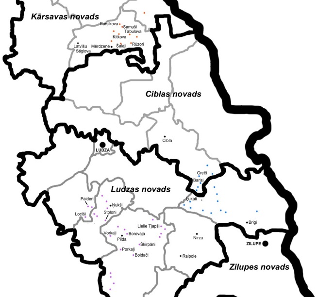
The map below shows the location of the villages in the gallery. The villages shown in purple are associated with Pilda, those in blue are associated with Nirza, and those in orange are associated with Mērdzene. Other significant cities and villages are shown in black. The black boundaries show current administrative divisions (municipality or novads, in Latvian). The grey boundaries show the former smaller administrative units (parish or pagasts, in Latvian), which ceased to exist as administrative in 2009, but still are used for reference and statistical purposes, and appear on many maps. It should be noted that in pre-World War II Latvia there also was an administrative unit called a pagasts, but the boundaries of these differed from the pagasts units that existed again between the 1990s and 2009 (which were based on the Soviet-era ciema padomes or “village councils”).

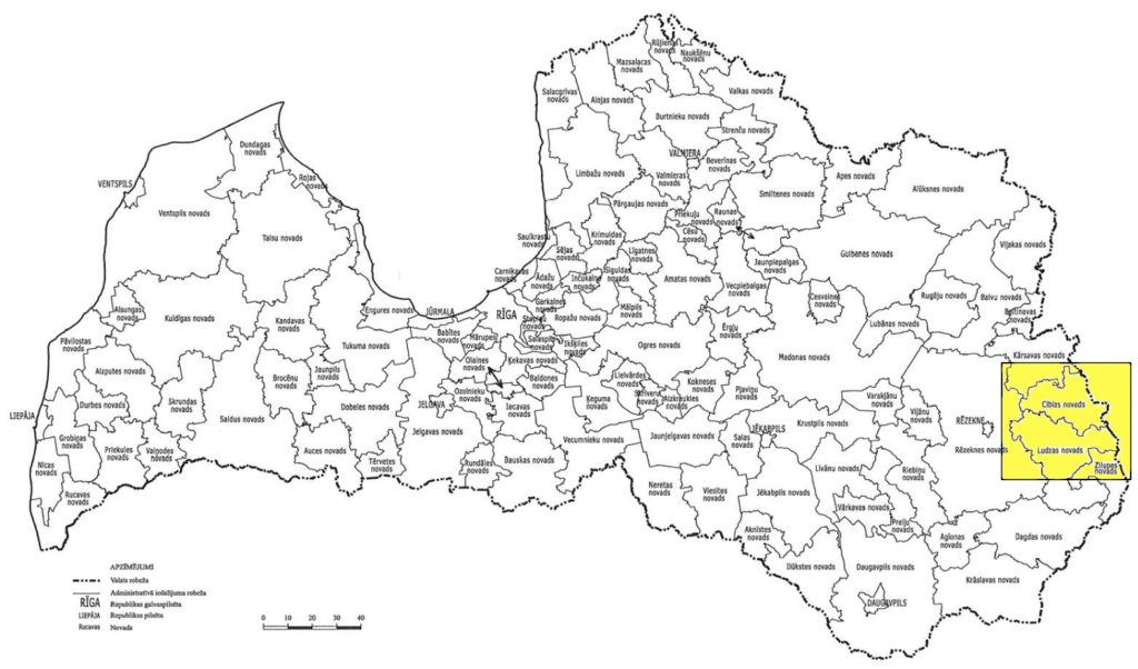
A map showing the location of this area within Latvia:

